Geographic Information Systems
About GIS
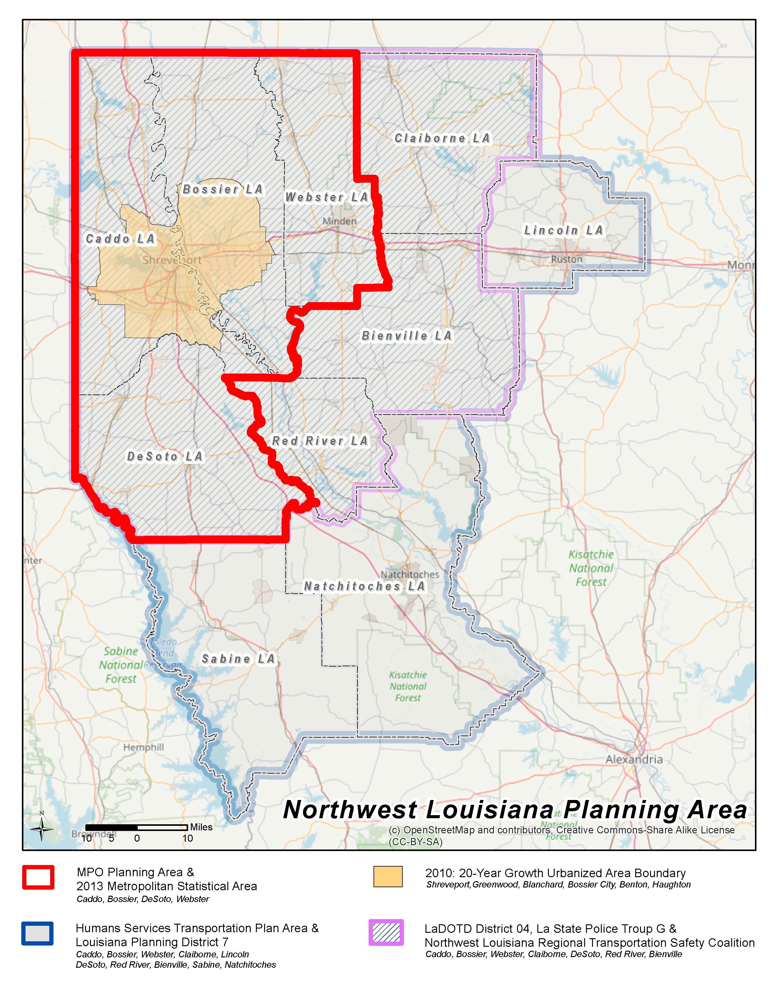
As a program of the Northwest Louisiana Council of Governments, the Geographic Information System (GIS) integrates hardware, software, and data for capturing, managing, analyzing, and displaying all forms of geographically referenced information across the region. To achieve this, the GIS team develops GIS layers with member agencies and provides maps and connections for each member agency, as well as for the public via data requests.
Benefits of GIS
Cartography and other mapping processes had their foundation in geography, whereas a GIS system enables computer automated processes to connect the dots in meaningful and impactful ways. The use of GIS allows for: